
Street Layouts and public place-making
 Planners have a large toolbox of ideas from which they can sift through when developing our built environment. Street layouts have played a large part in determining our movement patterns and transportation choices. From the grid pattern from early walkable towns (which the “New Urbanist” movement has attempted to resurrect; eg. Walkerville) to the ubiquitous cul-de-sac which suburbanites have come to believe is the ony choice when it comes to residential street types, each has their pro’s and con’s.
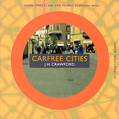
Now there comes a new choice in the global search for a better way to design our communities. And it was born not in Denmark or some other “progressive” country. It is from lil’ old Canada. A fellow participant in an international discussion group (started by Joel Crawford, author of the book Carfree Cities) investigating the benefits of developing car-free cities came across this web site describing a street network concept called the “fused grid“, proposed by Fanis Grammenos, a researcher at the Canada Housing and Mortgage Corporation.
Grammenos looks at the benefits and disadvantages of both cul-de-sac and grid street layouts, and proposes what he calls fused grids as an alternative combining the advantages of both. Partly inspired by the street layout of old Savannah, Georgia, fused grids combine an overall continuous grid for walking and cycling with a broken grid containing cul-de-sacs that prevent automobile through traffic within a neighbourhood. A fused grid can in principle be constructed either by overlaying suburban cul-de-sac and loop layouts with a network of continuous pedestrian and bike paths, or by closing off portions of a continuous street grid to car traffic, while leaving the grid open to
non-automotive travel.
This looks like a useful template for the early to intermediate stages of gradual, phased-in carfree neighbourhood conversions, especially for urban neighbourhoods built on a grid plan. Clearly, it could also be applied with varying degrees of success to suburban neighbourhoods ?? text and links on the website refer to an experiment in the southwest Ontario town of Stratford ??, but without extensive rebuilding and redensification, it’s unlikely you could go all the way to eliminating dependence on private automobiles in such cases.
Grammenos comes at the problem from the point of view of what can be done with currently existing road networks in order to shift some of the advantage over to pedestrians and human powered transport. From an email he sent me: “Ever since I became aware of the car free cities web site, I thought there were a lot of commonalities between the two concepts. One challenges people to consider a revolution and the other an evolution; both with the same goal - to give pedestrians more control. ”
Since his approach takes it for granted, without overtly stating so, that cars are and will probably remain an important part of urban transportation, this assumption colours his vision of how a fused grid would typically be constructed. For one, he only uses the term “street”only to refer to a route open to car traffic; pedestrian and cycle routes are “paths”. This implies that they are likely narrower than streets, and his drawings of fused grid plans seem to reflect this assumption. It also seems to imply that housing would only be located on “streets” and not on “paths”. This seems to reflect how fused grids might grow out of superimposing a pedestrian/cycling grid on a suburban street network. In a dense urban grid, shutting off streets or parts of streets to car traffic obviously need not imply that housing cannot exist without fronting on a car-centric street… Certainly, if fused grids are used as a tool for a phased-in carfree conversion, the ultimate aim would be for all residential streets to become carfree eventually. I think his assumptions are just an artifact of taking suburban street plans as the starting point for the process. Nonetheless, he does seem to imply ?? I may be misunderstanding him here ?? that areas blocked off to cars would need to lose some buildings to become “green” (i.e. park-like) areas, though that could in principle only apply to the asphalt-paved street surfaces themselves.
One thing that does strike me in his proposals is that fused grids only seem to be intended for the neighbourhood level, and not to the overall street grid. He accepts that main streets would remain car-centric, providing speedy thoroughfares for automobile traffic on primary, mixed-use streets bounding residential neighbourhoods. From a carfree conversion point of view, it would be just as useful, in the early to intermediate stages of conversion, to apply the fused grid idea to the larger primary grid as well, pedestrianising stretches of the streets while creating pedestrian/cycling boulevards
with unrestricted high speed public/freight transport access. Doing this at the larger level would bring home the message that carfree streets are not just for residential neighbourhoods, and ought to further discourage automobile traffic overall by making the automobile road network less convenient while at the same time making speedy public transit more attractive.
As I said in my earlier postings, I am surprised that most well-publicised pedestrianisation efforts ?? Copenhagen for example, and a large number of other carfree areas listed on this Wikipedia page ?? seem to concentrate on shopping streets and not on residential areas. Perhaps it is time to take a second look at how protocols could be put in place for much more ambitious phased conversions of existing urban areas to carfree status, something that I am sure will finally find its place on the public agenda in the not too distant future. For the typical North American city, an extended fused grid approach would be a very useful tool combined with the kinds of proposals Joel (Crawford) has already put forth. When the time comes that governments finally see the usefulness of moving to car-lite and eventually carfree cities, it will help a lot for this kind of work to be available as a template to consider.
A few more comments about the fused grids site:
- the web site has links to various papers, not all free access, as well as to the Carfree Cities web site among others
- one paper compares grids with radial designs, which are overall preferable for pedestrians; putting something like this in place would require some rebuilding near the middles of long blocks to allow the construction of sottoportego-type archways leading to
shortcut paths through the middles of such blocks. For illustration’s sake, the typical residential city block in Montreal is 500 metres long on its long side compared to merely 100 m on its short side. Shortcut routes through the length of a block at somewhere around 150 and 200 m from either end could help to reduce walking times considerably by making walking routes less circuitous overall. This might be one way a fused grid could be put into practice, beyond just shutting off streets to automobile access.


![]() Tags: mobility, pedestrian, place making, traffic calming, Urban Design, walkable
Tags: mobility, pedestrian, place making, traffic calming, Urban Design, walkable


It seems like a decent comprimise. The 5min walk benchmark is key I think and should be used as much as possible.
Sorry off topic and two days late but worth putting here!
“City staff says no to $80M ‘gift’ to widen Hwy. 174
Jake Rupert, The Ottawa Citizen
Published: Monday, April 14, 2008
OTTAWA - The city’s transportation planning staff are recommending the municipality say no to federal and provincial government offers of $40 million each to widen Highway 174 from Trim Road in Orleans to Rockland.
A staff report on the issue says the proposed 22-kilometre freeway isn’t needed and will encourage sprawl. It adds that a commuter-rail line could service the area, and the city doesn’t have the $15-million share the province wants it to pay.
It recommends the city refuse to even accept a grant of $5 million being offered by the province to do the preliminary studies on the road widening, which would include about seven kilometres inside the city’s boundaries……”
Full story here:
http://www.canada.com/ottawacitizen/news/story.html?id=ffe9f76a-161e-4e9e-947c-f76c8505ae12&k=47141
I wonder if the mayors of Tecumseh and Lakeshore would say the same thing!
Wow, has anyone shown this to Dwight or Sandra
At Last - some common sense.
W has an ideal fused grid structure (a very basic grid infrastructure, intersected by rail tracks and diagonals - and other features).
This seems like a reasonable philosophy to build on over the next 5 - 15 years.
How do we make it happen? Official Plan, Enviro-Master plan.. or what.
Any ideas out there. I’m in.
Dave
Ugh, not the fused grid. Like most ’solutions’ to so-called urban sprawl, it’s not new. We have an example (minus the parks) of it in Windsor in the area bounded by College, Partington, Tecumseh and California.
I find it interesting that people like to use Europe as the example of car-free or public transit environments. Meanwhile they ignore that most European countries are constructing new and expanding existing networks of highways including tunnels under their major cities. Yes, the Europeans love their car-free areas and public transit, but they love their cars just as much as North Americans.
So what’s wrong with asking questions like “what can be done with currently existing road networks in order to shift some of the advantage over to pedestrians and human powered transport?” Do you not feel that should be a priority to make our communities a little more livable? If this doesn’t too far enough, or heads in the wrong direction, what can you point us to that would work better in Windsor? What is it about the “fused grid” that makes you go ugh?
Absolutely nothing wrong with asking those questions. And where did I say I didn’t want to make communities more livable?
The fused grid is not so much about liveable or walkable areas; it is about keeping out vehicular traffic that is not welcome. It’s really not much different from the curvilinear road system in Forest Glade - they are both designed to confuse the non-resident traveller.
Give me the grid system any day. It’s logical and it provides multiple routes to and from your residence. It works for all modes of transportation and emergency services. Throw in a block numbering system like in Windsor, and you got the best, simple and straightforward transportation system.
I didn’t mean to imply that you didn’t want to make our communities lmore livable, it just sort of read through that way.
One of the main reasons I continue to plug away with this website is my belief that by establishing a dialogue with the residents of this city, we can reason our way through the diatribe, propaganda and platitudes and find a fix that will really work in this city.
I agree with you about the grid layout for our city streets. My reason for posting about the fused grid is that maybe we can find a way that we can retrofit some of our established road networks that may not serve the purpose that they were initially designed for, to make them augment the quality of life of those residents living on them. I really want to investigate all possible options so that we can advocate for the best one.
What would you do with those incredibly confusing cul-de-sacs and labyrinth-style dead-ends to make them more appropriate, assuming that “wiping the slate clean” and rebuilding is not an option? I can’t count the number of times I’ve found myself lost in neighbourhoods like Forest Glade and went away hating the neighbourhood because of it.
Woonerf!
Google search for Woonerf:
http://www.google.ca/search?hl=en&q=woonerf&meta=
Wikipedia: Woonerf
http://en.wikipedia.org/wiki/Woonerf
Congratulations to Erie street and their initiative, Woonerf would be a good idea for that street, downtown, Ottawa street, and all core neighbourhoods. Think of it, the pedrestrian is king and queen NOT the car! No streets have to be closed to traffic, just slow them down.
i hate going into Forest Glade for anything! To bad it is like any other place in North America..boring!
I’m waiting as soon as I can to request the same thing.
It just makes sense, parking in the winter when everyone uses their car, and public spaces in the summer.